Results & impact 2 April 2024
- Home
- Press area
- Press releases
- Mapping the world's plant biodiversity
A massive effort to map the world’s plant biodiversity

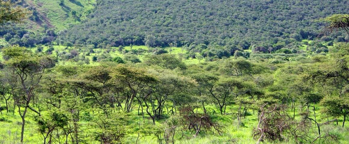
Open and dense forests of Akagera National Park, Rwanda © C. Doumenge, CIRAD
Just a few weeks apart, Nature Ecology & Evolution and Nature Communications have published two world maps of tree and plant biodiversity, seen from different angles. Because of their scope and their unprecedented inventory efforts, these two complementary studies will serve as new references for future conservation policies.
CIRAD contributed to this research with its partners in Africa and the Amazon, providing data from inventory plots in tropical areas. The scientists also provided their expertise on the measurement of biodiversity and interpreted the original results obtained for the inter-tropical zone.
Tropical forests: their species richness does not depend on the climate alone
In this study led by the Global Forest Biodiversity Initiative, 249 scientists from more than 50 countries analysed the biodiversity of 55 million trees in 1.3 million plots throughout the world. Published in August in Nature Ecology & Evolution, the results cover 97% of the world’s forests and provide an unprecedented level of detail to understand geographical variations in local tree biodiversity.
Local species richness, in other words the number of species co-occurring within one hectare, is a key measurement of biodiversity. Forests close to the equator have on average 98 different tree species. This figure gradually diminishes, stabilising at four species per hectare at 50 degrees north or south. According to the study, the most diversified tropical forests are found in the Amazon, sometimes with more than 200 tree species per hectare. The equivalent for temperate forests is situated in the forests of southern central Chile, with 50 species per hectare.
Beyond this inventory, the study details the drivers of the species richness observed. Although biodiversity models have so far focused on temperature and rainfall, this new research shows that there are other factors that explain the variability of biodiversity in tropical areas. The topography, the nature of the soil and, nowadays, the impact of human activities are all variables of co-limitation along with the climate.
Mapping plant biodiversity at all scales
It is essential to take account of the effect of the size of the zone observed when mapping the world’s biodiversity, according to this second study led by Martin Luther University Halle-Wittenberg and the German Centre for Integrative Biodiversity Research Halle-Jena-Leipzig. The authors of the study, published in September in Nature Communications, thus analysed 170 000 vegetation surveys from all of the different climate zones, using the sPlot database.
The vast majority of studies on global biodiversity are conducted at a large scale, for example a state or a region. However, by reducing the scale of the areas observed, the scientists discovered that some notable differences in the level of diversity between tropical zones and temperate zones tended to disappear. For example, at a very small scale, the steppes of Eastern Europe in Siberia and of some Alpine countries in Europe have a level of plant biodiversity comparable to the Amazon rainforest.
These findings question certain preconceived ideas, for example concerning the vegetation of West African ecosystems, which is considered to be low in biodiversity for a tropical zone. The study nevertheless shows that West African species are distributed across very large distances, and therefore do not necessarily appear in measurements from small sampling areas. To better understand West African biodiversity, the scientists thus underline the need to survey a large number of small plots.
New references for conservation policies
These maps are a world first and are leading to recommendations for future conservation policies. First, in the tropics, public policies will need to take account of the multiplicity of co-limiting factors for biodiversity, including human activities. Next, in order to be effective, conservation policies will need to integrate variability in the spatial distribution of plant species.
“In West Africa, where the environmental gradients are steep and abrupt, conservation efforts for flora will be more effective if they are targeted at multiple medium-sized zones, with different bioclimatic conditions, rather than at just a few very large zones”, says Bruno Hérault, an expert in tropical forests at CIRAD and co-author of the two publications.
Unprecedented inventory efforts in Côte d’Ivoire
This research was made possible thanks to an international network involving several hundred scientists with expertise in vegetation in the different parts of the world. CIRAD contributed through its fieldwork in partnership. In Côte d’Ivoire, a substantial inventory effort has been made over the last few years, with several hundred permanent plots set up in natural or production forests, plantations, agroforestry systems and secondary forests. “This inventory was conducted jointly with our partners at INPHB and UFHB, among others. The collaborative research allowed the Ivorian doctoral students and colleagues involved to share their viewpoints and their field expertise in order to interpret the initial findings, while integrating these international networks on a permanent basis”, says Bruno Hérault.
Despite these unprecedented efforts to survey and explain plant biodiversity at the global level, there are still many uncertainties in the tropics. According to Bruno Hérault, “our knowledge there is still very fragile, and we need to pursue inventory efforts, which are crucial to the implementation of biodiversity conservation policies”.
References
Liang, J., Gamarra, J.G.P., Picard, N. et al. 2022. Co-limitation towards lower latitudes shapes global forest diversity gradients. Nature Ecology & Evolution
Sabatini F. M. et al. 2022. Global patterns of vascular plant alpha diversity. Nature Communications


